
In a January article we looked at several variables related to household internet and devices to better understand Indiana’s digital landscape. Results showed that the share of households with no internet access decreased across its urban, suburban, and rural areas.…
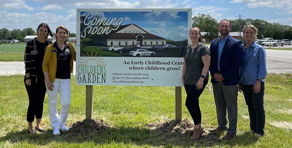
Flora, Indiana – Childrens Garden, a new childcare provider, celebrated a significant milestone last Friday as they broke ground on their new facility located in Flora, IN. The event marked the commencement of a project aimed at addressing the critical…

The Purdue Center for Regional Development (PCRD) is excited to welcome our new Engagement Specialist, Hyewon Shin, to the PCRD team. She studied public administration at the University of Arizona Eller College of Management and international studies at Ewha Womans…

Written by Ben St. Germain, Bertin Mbongo, Andrey Zhalnin, and Indraneel Kumar. Industry clusters are a group of firms and business establishments that buy from and/or sell to each other. They can use similar technologies and share similar skilled labor…

Indraneel Kumar, associate director of the Purdue Center for Regional Development (PCRD), has been assigned the new role of director of PCRD on May 1, 2024. Kumar has been with PCRD since its inception in 2005. His work has focused…
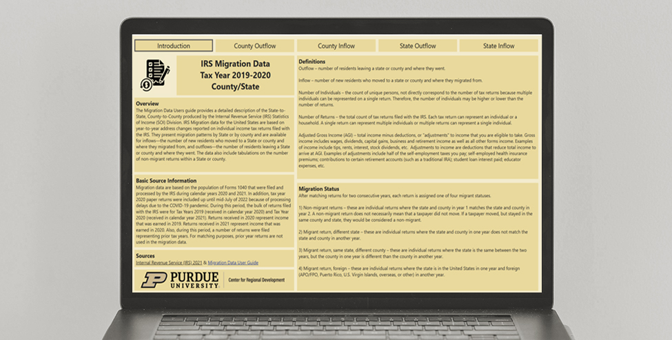
The Purdue Center for Regional Development (PCRD) has developed an online tool to present migration data across U.S. County and state level geographies. Migration data is provided by the Internal Revenue Service (IRS) statistics of income (SOI) division. Data is…
The United States Department of Agriculture (USDA) Economic Research Service (ERS) has been compiling a rural urban continuum code (RUCC) every ten years since 1983. This continuum distinguishes metropolitan and nonmetropolitan counties by their population size, degree of urbanization, and…

The American Community Survey 5-Year Estimates (ACS-5 Year) continues to expand its list of variables. In the latest iteration, the ACS 2018-2022 has added the variable “Median Earnings in the Past 12 Months (in 2022 Inflation-Adjusted Dollars) by Sex by…