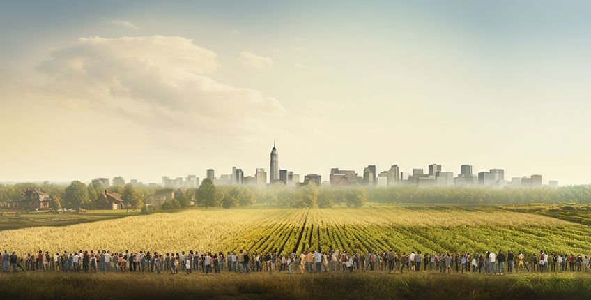
Some Insights from Census 2020 Urban and Rural Population Distribution in Indiana

Whether a county is urban, rural, or somewhere in between is of interest to decision-makers, policy and planning practitioners, and researchers alike. One of the reasons is that many federal programs for urban or rural areas are based on formula grants, which means the number of people in urban or rural areas can make a difference in the amount of funds allocated to the local government. Many discretionary federal programs, which are competitive, can include specific provisions for urban or rural constituents. Number and share of population residing in urban or rural areas can designate a county as an urban or a rural providing access to specific resources.
There has been plenty of research to develop urban and rural county classifications in the U.S. Noted among those are classifications developed by the Economic Research Service (ERS) and the U.S. Department of Agriculture. The Rural-Urban Continuum Codes classify counties into nine categories, three metropolitan and six non-metropolitan, based on the level of urbanization and adjacency of a metropolitan area.1 Urban Influence Codes was a 12-part county classification system developed by the ERS based on population size of metro counties, and population and hierarchical adjacency of micropolitan and noncore counties in the U.S.2 You may have noted that metropolitan and non-metropolitan designations form the basis for these classifications. A metropolitan or non-metropolitan (micropolitan and noncore counties) designation is delineated by the Office of Management and Budget (OMB) of the U.S. Census Bureau. The delineation is based on the population size of the core nucleus area and socioeconomic ties between core and adjacent areas based on commuting.3 Refer to Rural Indiana Stats for simple descriptions and maps of the classifications developed by the U.S. federal agencies.4
SnapTik: TikTok Downloader
Now download TikTok videos and highlights directly from the Tiktok – tiktok downloader
TikTok Video Downloader includes
SnapTik permits individuals to easily save as well as access their content in one location, getting rid of the requirement to browse several systems to discover what they are seeking.
SnapTik provides innovative privacy attributes, making sure that saved web content is safe as well as secured.
SnapTik Downloader uses a easy to use user interface that makes it easy and user-friendly to use, even for those that are not tech-savvy. This, together with the app’s integrity and also rate, make it a preferred option among users.
Why use an TikTok Video Downloader? SnapTIk is a leading selection for customers aiming to save, organize, and access their preferred material from social networks. With its sophisticated attributes, easy to use user interface, as well as privacy securities, it is the suitable app for anybody wanting to keep a convenient and secure archive of their favorite material.
In addition to classifications developed by the government and quasi-government organizations, researchers have also developed county-level classifications. The Index of Relative Rurality (IRR) was developed by Purdue University faculty members and researchers. In contrast to the discrete classification systems described in the above paragraphs, IRR is a continuous and threshold-free classification system.5 The IRR has a bounded scale and ranges from 0 (Urban) to 1 (Rural). It is using population size (logarithm), population density (logarithm), remoteness (network distance), and built-up area (urban area as a percentage of total land area as the variables).6
Researchers at Purdue University have developed another classification system focused on Indiana counties. This classification divides counties into urban, rural/mixed, and rural areas based on total population, population density, population of the largest city, and a qualitative indicator of identity.7 The identity is a subjective indicator of perceptions of county residents.8 The map for this classification is available at Rural Indiana Stats.9
A user has several options if he/she wants to use urban or rural classification of a county. For 2020, the U.S. Census Bureau has delineated urban areas at the block level, which is the smallest census geography. The census bureau identifies a minimum threshold housing units per square mile for an urban nucleus including other criteria of amount of impervious surface present, block shape, adjacency, group quarter presence, etc.10 Once “urban” blocks or areas are identified, the designation of “rural” is given to population, housing, and territory not included in an “urban” area.11
Hence, census designations provide housing units and population for “urban” census blocks. The remaining census blocks are designated “rural.” Because census blocks are contained within higher census geographies such as tracts and counties, population and housing units in urban and rural parts of counties can be estimated. Census has published the 2020 urban and rural data for each county. At the county level, census provides the following useful information:
- percent population in urban and rural;
- housing percent in urban and rural;
- population and housing units in urban and rural;
- land area in square-mile and percent in urban and rural; and
- count of census blocks in urban and rural.
These are useful statistics to see if a county in Indiana has more population in urban or rural blocks or areas. For example, Adams County (Federal Information Processing Standards-FIPS 18001) in Indiana has 70.84% population residing in rural and 29.16% population residing in urban areas. Benton County, which is part of Lafayette-West Lafayette metropolitan statistical area, has 100% population residing in rural areas or blocks in the Census 2020 data. In contrast, Marion County (Indianapolis) has a 99.12% urban and only 0.88% rural population distribution. This classification recognizes that even in a large metropolitan county such as Marion County, there can be few census blocks that meet the rural criteria.
We are providing an interactive map at the county and census block levels for general purpose usage. We follow a simple criterion used previously by the Stronger Economies Together Program funded under the aegis of the U.S. Department of Agriculture. If a county has more than 50% population residing in rural areas or rural census blocks, it is designated as a “rural” county per Census 2020 data. If more than 50% populations are in urban areas or urban census blocks, it is designated as an “urban” county. The basis for this classification is if more populations are residing in urban or rural parts or census blocks of the county.
Clicking on a county in the interactive map above will provide the county name, urban or rural designation, population, households, and population density by urban or rural designation. Zooming in from county to census block level will identify if the block is urban or rural. Clicking on the block will provide urban or rural designation, population, and households units.
- https://pcrd.purdue.edu/ruralindianastats/geographic-classifications.php
- https://www.ers.usda.gov/data-products/urban-influence-codes/documentation.aspx#Methodology
- https://www.census.gov/programs-surveys/metro-micro/about.html
- https://pcrd.purdue.edu/ruralindianastats/geographic-classifications.php
- https://purr.purdue.edu/publications/2960/1
- https://ageconsearch.umn.edu/record/21383
- https://www.extension.purdue.edu/extmedia/ec/ec-766-w.pdf
- https://www.extension.purdue.edu/extmedia/ec/ec-766-w.pdf
- https://pcrd.purdue.edu/ruralindianastats/geographic-classifications.php
- https://www.federalregister.gov/documents/2022/12/29/2022-28286/2020-census-qualifying-urban-areas-and-final-criteria-clarifications
- https://www.federalregister.gov/documents/2022/12/29/2022-28286/2020-census-qualifying-urban-areas-and-final-criteria-clarifications

Indraneel Kumar is the Director for the Purdue Center for Regional Development (PCRD). Indraneel has been at PCRD since its inception in 2005. He focuses... read more


